Wetlands are any environment that is completely or partially submerged in water, either permanently or temporarily...
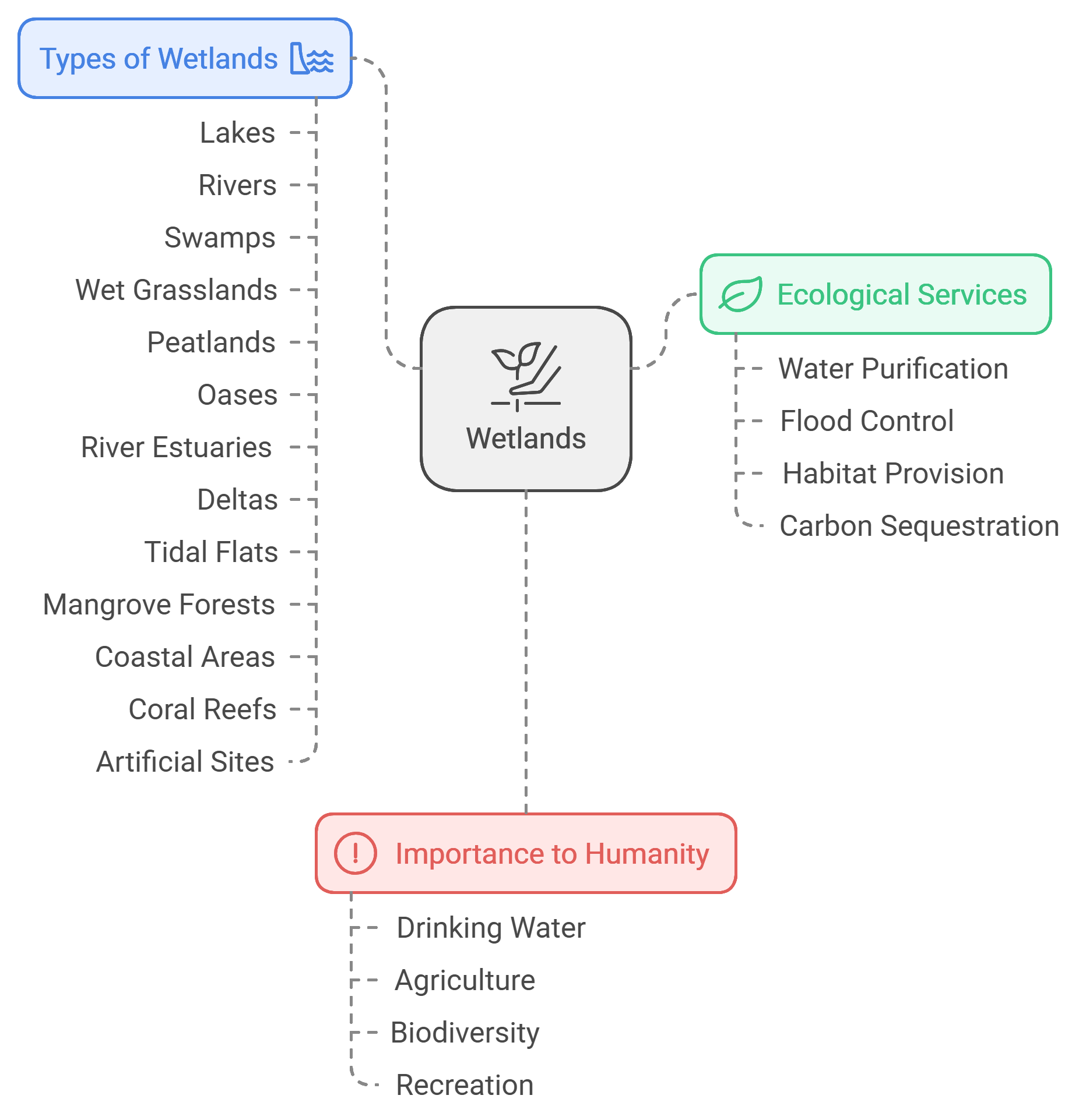
Wetlands are any environment that is completely or partially submerged in water, either permanently or temporarily...
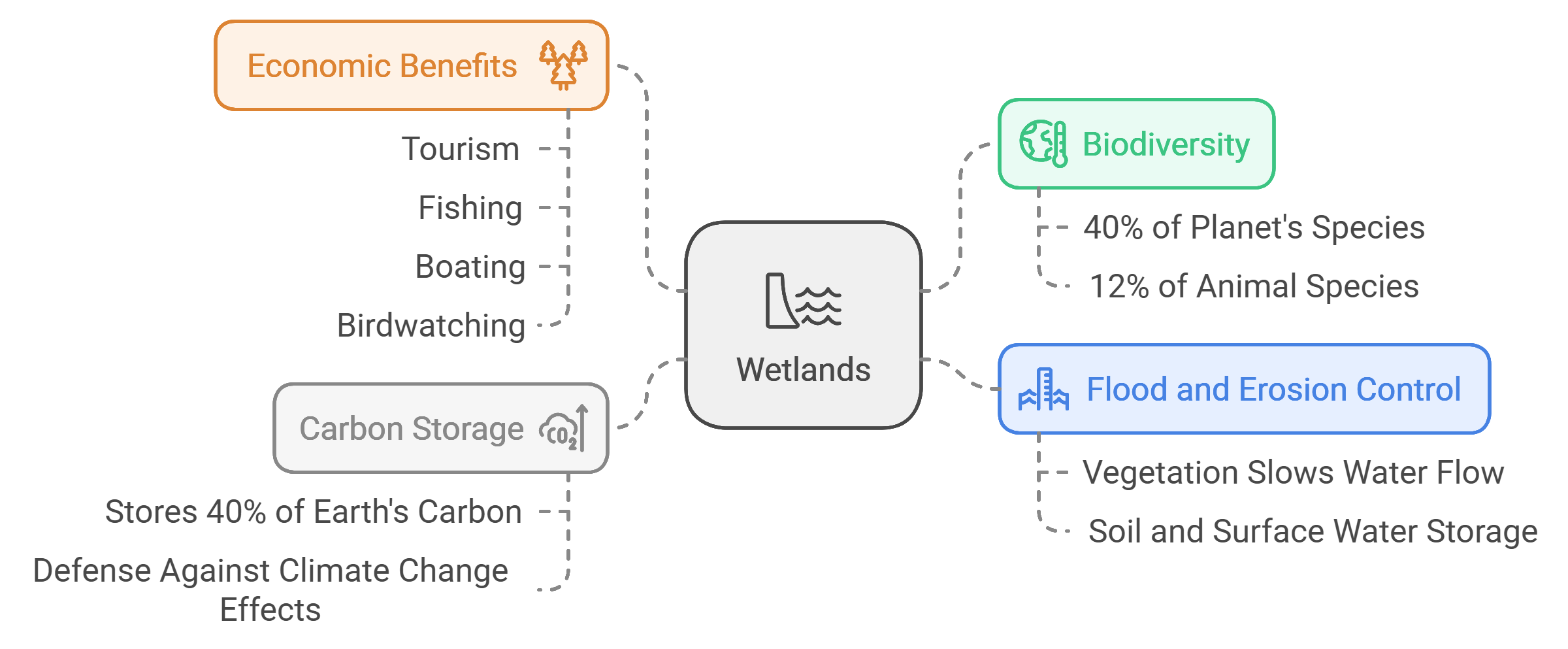
Wetlands are among the richest environments in terms of biodiversity, hosting significant numbers of various species. Freshwater wetlands alone house more than 40% of the species on our planet and 12% of all animal species. Wetlands serve as a natural barrier against floods and soil erosion. When water levels rise due to heavy rains, the vegetation in wetlands slows down water flow and stores part of it in the soil or on the surface, thus naturally reducing the risk of floods and erosion.
Moreover, wetlands are a vital source for carbon storage, which is the primary cause of global warming. Estimates suggest that wetlands store up to 40% of the Earth's carbon, making them one of the first lines of defense for coastlines and inland areas against some of the effects of climate change, such as increased storm intensity and frequency, altered rainfall patterns, and rising sea levels and temperatures.
Wetlands also support local communities economically, as they are ideal destinations for tourism. Various activities can be conducted in wetlands, such as fishing, boating, and birdwatching, providing sustainable economic opportunities for nearby communities.
The project area (targeted wetlands) is located in the northeast of Libya (32.544038°,23.087579°), within the administrative boundaries of the Um al-Razam municipality, which was previously part of Derna province. The Um al-Razam municipality includes the following local branches: Al-Tamimi and the Gulf of Bomba. The region is characterized by a coastal plain interspersed with some hills, and it generally lies at an elevation of no more than 100 meters above sea level. The area consists of two geomorphological units: the coastal plain (ranging from 0 to 20 meters in elevation) in the east, and the hilly region (ranging from 20 to 220 meters) in the west and south. The targeted project area covers approximately 477 hectares.
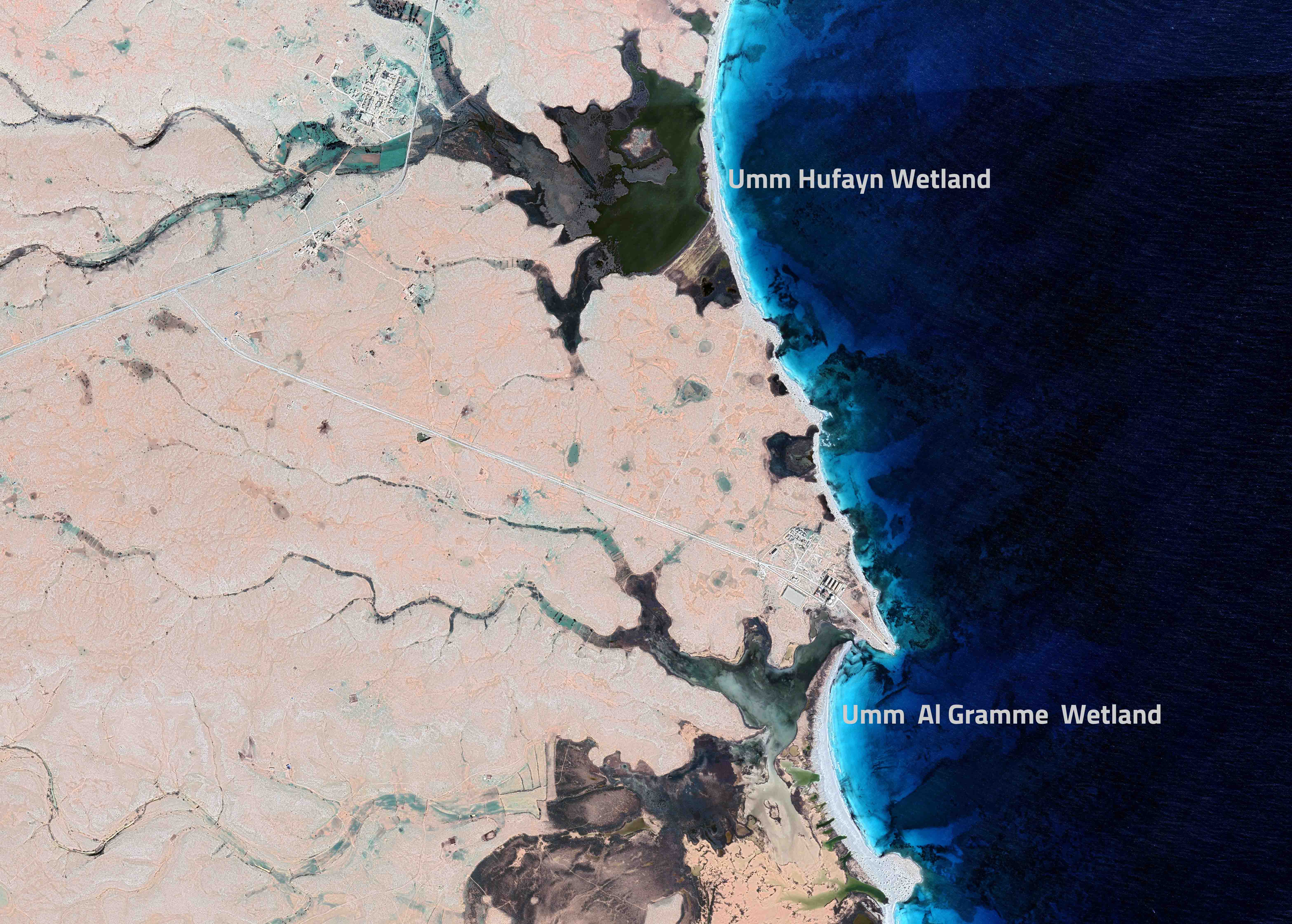
Umm Hufayn Lake covers an area of approximately 200 hectares, with water depths ranging from 0.5 to 3 meters, while Umm Al-Qurami Lake covers an area of about 277 hectares, with water depths ranging from 0.5 to 2 meters. Both lakes are connected to the sea through narrow channels, allowing tidal waves to flow in and out. Groundwater, which discharges low-salinity water from inland areas, also feeds both lakes.
These lakes represent an important site, where some local residents practice livestock grazing on the pastoral plants around the lakeshores and engage in fishing, with some fishermen utilizing Umm Hufayn Lake for fish harvesting. The lakes attract many visitors during the summer, as well as hunters who target migratory birds.
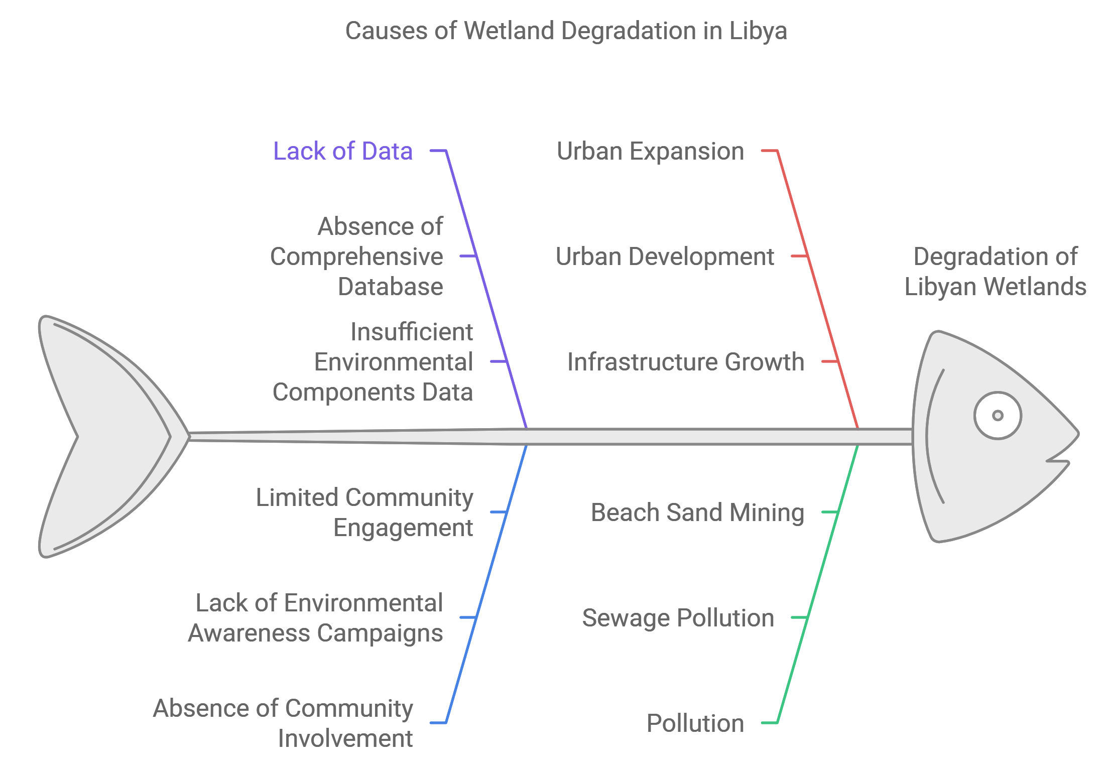
Despite the richness of the Libyan coast with various wetland sites, the lack of data regarding their environmental components and spatial characteristics creates a knowledge gap and limits the ability to assess these areas. Relying on such data will contribute to developing plans for the sustainable conservation and management of wetlands, as well as offering important recommendations to relevant government authorities to adopt policies that help preserve or restore degraded wetlands. The two selected sites lack a comprehensive database that includes spatial and biodiversity data. Additionally, the absence of community involvement, due to the lack of environmental awareness campaigns, has contributed to some areas being affected by urban expansion, beach sand mining, pollution from sewage, and overfishing.
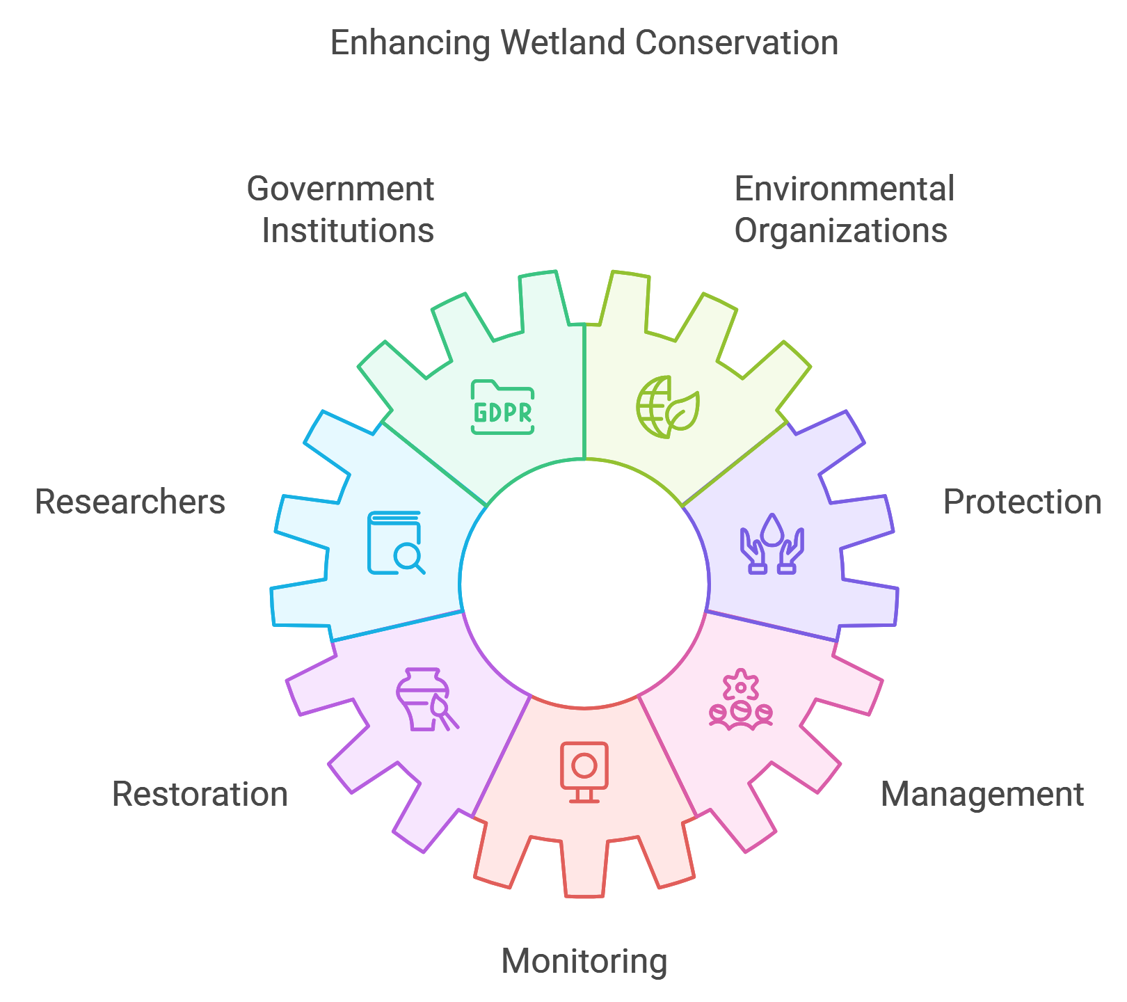
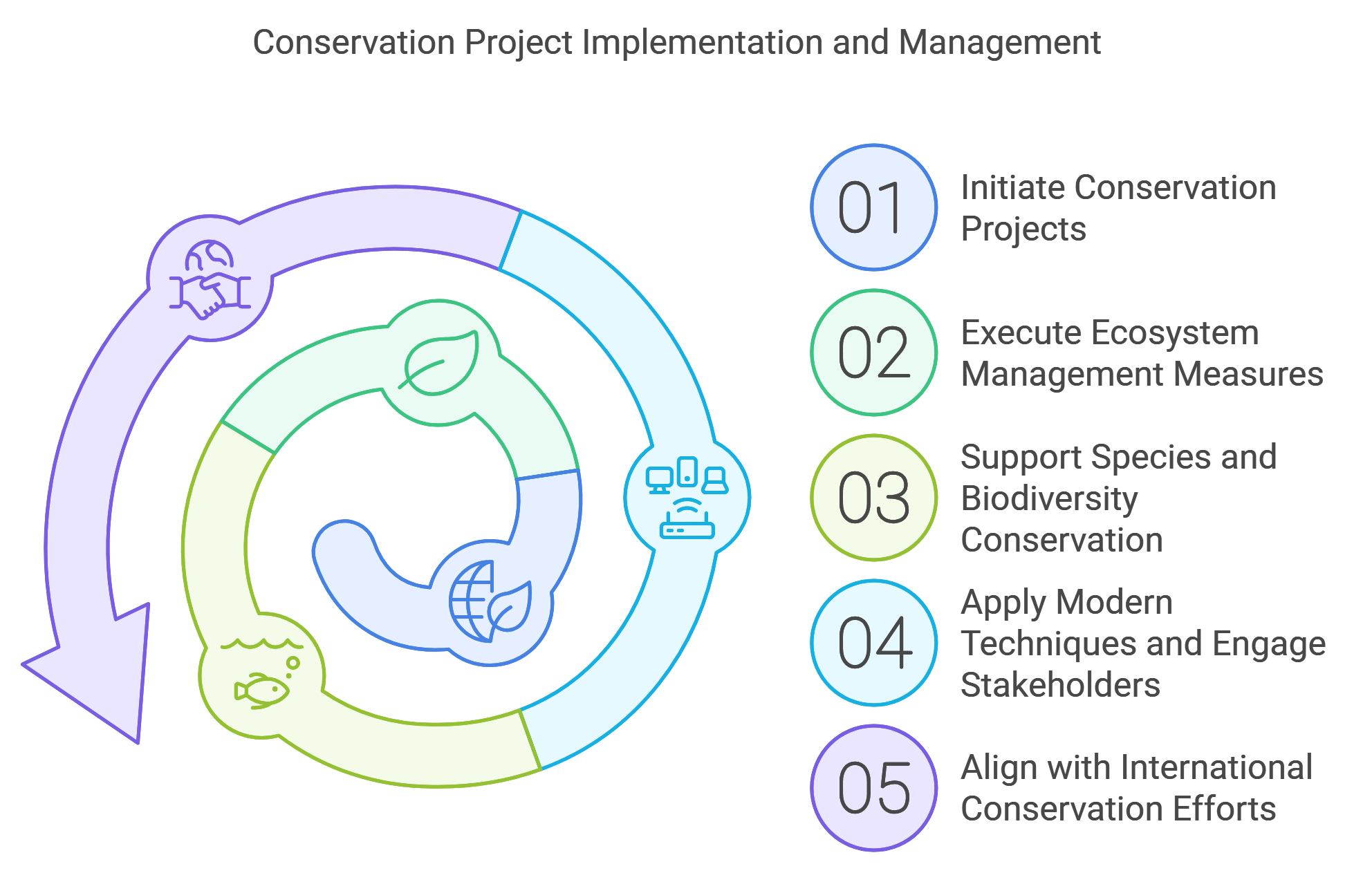
The project aims to conserve species, ecosystems, and areas of exceptional biodiversity by providing a wetland database. This will allow government institutions, environmental organizations, and researchers to access this information, enhancing the ability of stakeholders to contribute to wetland management through protection, restoration, management, and monitoring.